Cartostation
Cartostation is a modular, open-source web GIS for map publication. It is a web application platform offering tools for managing, displaying and publishing spatial data. These functions are available online, through carefully designed interfaces, with the aim to make this tool available to as many people as possible.
Cartostation is currently deployed in the Brussels-Capital Region (Brussels Environment and Perspective.Brussels) under the name Geodata, and on behalf of various associations and NGOs.
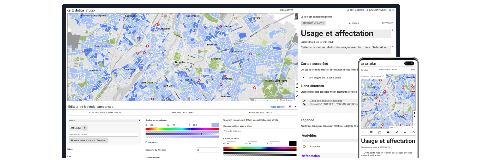
Studio
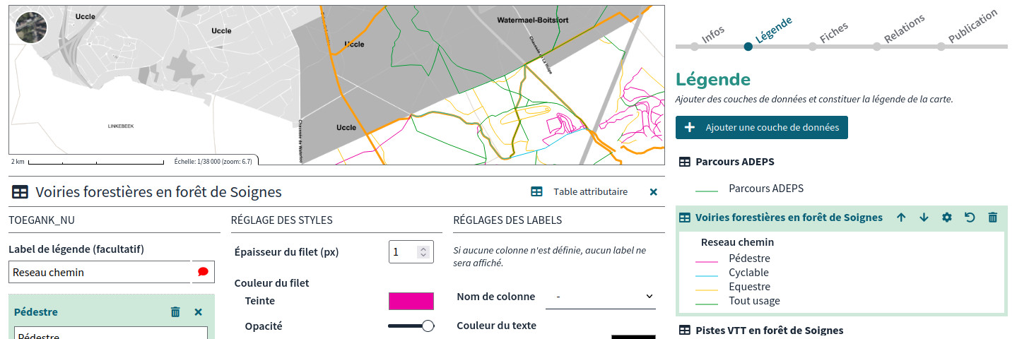
Studio is a Cartostation web application designed to facilitate the
creation, edition and publication of maps on the web. The Studio
allows you to create categories, generate graphic style, and
graphical visualisation for each data layer. The interface is
relatively simple, and is optimised for the creation of thematic
maps with a strong editorial dimension, aimed at a wide range of
audiences.

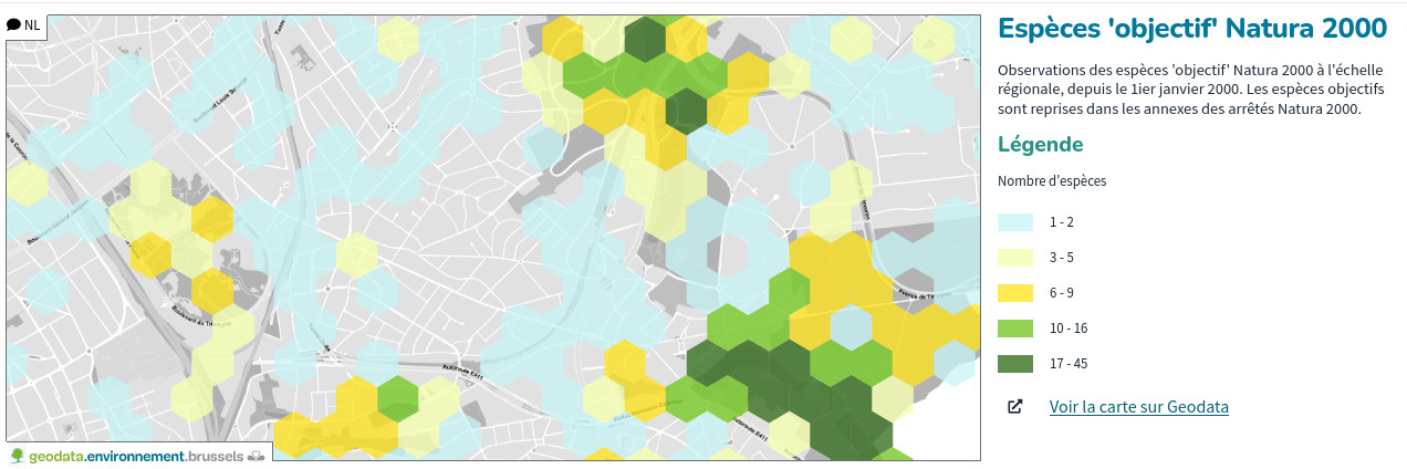
Atlas
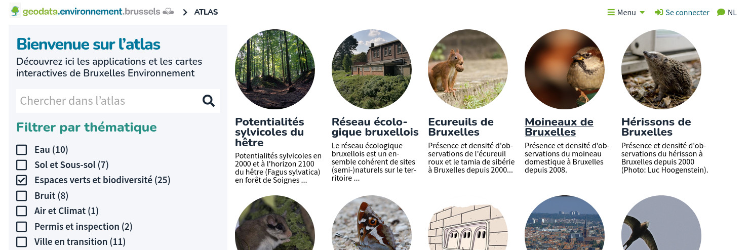
The Atlas application compiles the maps created in the Studio application on the Cartostation platform. In addition to the classic map navigation functions, access to the legend and the map's editorial content, it includes a series of tools for a more in-depth data consultation.
Metadata
The metadata application is used to edit the metadata associated with Cartostation data layers. Some of this metadata can be generated automatically, while other, more qualitative, must be entered manually by the people responsible for the data.
This application was first developed in response to the INSPIRE directive in the very specific context of its use at Brussels Environment, and has been improved as needs have arisen.
Alias

The Alias application can be used to create aliases for values from underlying data structures configured to be supported by this module. For example, the column names of database tables may be abbreviations or technical codes that are of little interest when this information needs to be communicated. Even more when, in certain contexts, this information must be available in different languages. The Alias application therefore makes it possible to compile a dictionary of aliases and translate these abbreviations into more legible information for a targeted audience within the applications of the Cartostation platform.
Embed
Embed is a Cartostation module that provides a simplified version of the map viewer used in the atlas , for embedding maps on third-party sites. This application presents the map, its title, description and legend, as well as features for selecting elements on the map. A link to the map in the atlas allows you to view the map in a more comfortable and complete context.
Monitoring
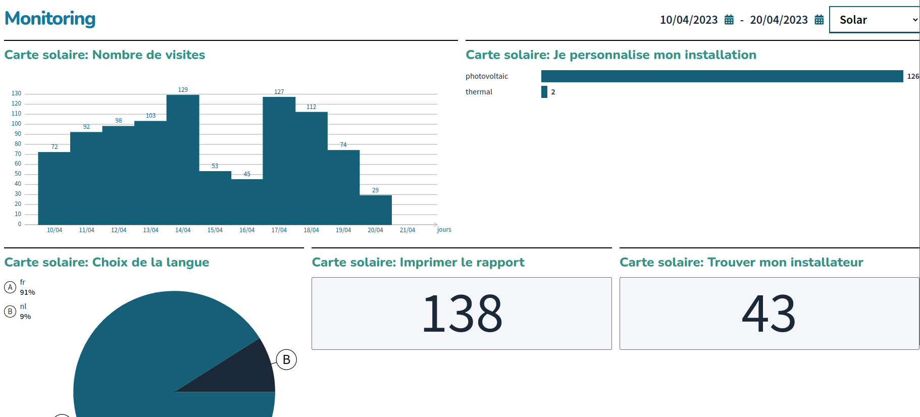
Statistics is an application integrated into Cartostation that allows you to monitor the use of the platform.