Infiltrasoil
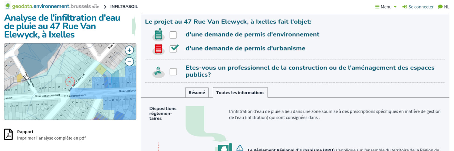
 Infiltrasoil is a portal for displaying and distributing data related
to the infiltration capacity of soils in the Brussels-Capital Region.
Infiltrasoil is a portal for displaying and distributing data related
to the infiltration capacity of soils in the Brussels-Capital Region.
 This application has been designed for professionals and the general
public,
This application has been designed for professionals and the general
public,
 and is integrated as a complementary module to the Geodata platform of
the Brussels Environment administration.
and is integrated as a complementary module to the Geodata platform of
the Brussels Environment administration.

Client :
Bruxelles Environnement
Partners :
Champs-Libres S.C.
Timeframe :
2022
Technologies :
Cartostation
Links :
InfiltraSoil